
Previously:
Camino Inglés 1: two ways to prepare for a pilgrimage
Camino Inglés 2: Isle of Wight Coast Path (eastern half)
Any illusions that I might have had about being the sensible one (who knew when to stop) were shattered by the third day. This was a day that would have been much improved by my stopping at Shalfleet for lunch. I didn’t, and I was miserable, although I did see some interesting things. Consequently, the first half of this post is mostly pictures.
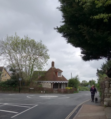
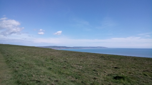
I started out with a bus trip, of course, back to the Round House where we’d caught the bus home yesterday, and found my way back down to the seafront at Gurnard. The coast along this first stretch was not spectacular, with low earthy banks sloping gently down towards the sea, but there were interesting things to see: woolly black sheep; a fox; dwellings made from railway carriages. It was when I went inland that things got tedious.
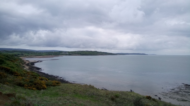


The trouble with the north-west coast of the Isle of Wight is that there’s a lot that has to be got around. There’s the Ministry of Defence land at Porchfield (which meant interminable road walking for me) and then there are all the creeks and swamps that go into the Newtown River. In between the two there is Shalfleet, where I should have stopped. Instead, I pressed on along paths and duckboards towards Bouldnor, hating everything. Particularly myself.


I’d meant to lunch in Yarmouth. And so I did. At half past four. I considered going on to the Needles, but thought it better not to take my bad mood along one of my favourite stretches of path. So I wandered around the town a little bit and then took the bus home.


It occurred to me that it was possible that on my previous Coast Path walk I’d managed a five-day walk in six days, rather than (as I’d thought) a four-day walk in five. This being so, I was unlikely to manage the whole thing in four days. I decided that this didn’t really matter. I’d already walked the entire circumference before, and this was really an exercise in knowing when to stop.
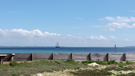
The westernmost tip of the Isle of Wight is always beautiful, and on a sunny day it’s glorious. I got the bus back out to Yarmouth and set out westwards. After a quarter of a mile or so alongside the beach the Coast Path heads up and a little way inland into Fort Victoria Country Park. Wide paths slope upwards through woodland, and eventually a narrower one pulls you up above the tops of the trees, and the Solent is there, now with the context of Hurst Castle and the Hampshire coast on the far side.

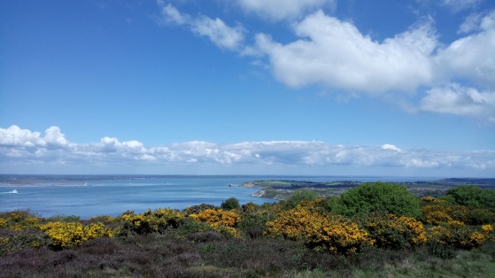
I pressed on along a shore that was always changing and would always change, through sleepy Totland and down to the sea again, past the sad remains of its pier; up, along the springy turf and the gorse bushes of Headon Warren. The gorse was out in exuberant bloom and alive with bees: no question about whether kissing was in fashion at the moment.

At the Needles Park I stopped for an ice cream, feeling sweaty and unkempt and wildly out of place among those who had come to ride on the chairlift and fill jars with coloured sands, although of course it was unlikely that I was the only walker there that day, or even that minute.
I kept going westwards, still higher, climbing the road where only the buses and the pedestrians go, and seeing the sea blue far below me, and the white crumbling chalk of the path, and the grass dotted yellow with cowslips.

I went as far west as you can without paying to get into the Needles Old Battery, and took a superficial look at the rocket launch site and the coastguard station. Then I turned east again, climbing a steep path up past the coastguards’ cottages and towards Tennyson Down.
I heard, and then saw, skylarks rising up from the long grass: the first time that I could remember. I kept on up towards the Tennyson memorial. The grass was very short here, by contrast, cropped close by cattle. Up and up, and over and down the other side: it was a lovely walk, but for the lingering spectre of the Last Bus. I didn’t really want to have to cut things short at Freshwater Bay, but if I went any further along the south-west coast and the Military Road then I’d be off the route of the regular service buses and would have to time things carefully so as to be sure of catching the once-daily-in-each-direction Coaster.
All the same, I stopped in a café for a sit down and a cup of coffee and a chocolate bar before I committed.

At the eastern end of the beach I met a whole party of walkers coming the other way. I had to wait for them at the bottom of the steps. 19, they said. I didn’t count them. After a sharp climb up, I was walking parallel with the road and watching the coast unfolding in front of me, bay after bay.
I did my best to ignore a dull pain in my toes. There were other things to think about. An adder, slithering out of the way before I reached the bottom of the steps down from road level. Cows. (I was more worried by the cows.) And where to stop. I thought about pushing on to Isle of Wight Pearl, but there are public lavatories and an ice cream van at Compton Bay, and both were worth stopping for.
I got the bus home, and left the southernmost points unwalked. In fact, I’d walked around about as much of the Island in actual size as I had around the paddling pool. Coincidence, of course. Wasn’t it?
Next time: a family wedding; we actually set foot in Spain, crossing it in two trains; and what’s going on with that pain in the toes? Probably more photos, too.

It looks like mare’s tail to me; one of those prehistoric plants that are almost impossible to eradicate. Our garden used to be full of it, 3 feet tall. We are prosecuting an interminable and unwinnable war against it, slowly reclaiming territory foot by foot.
LikeLike
Ah, thank you. Yes, it does look very much like it should have a giant dragonfly whooshing past it.
LikeLike
For obvious reasons, it makes me happy to see pictures of the Isle of Wight coastline 🙂
LikeLiked by 1 person
Annoyingly, the Coast Path still goes inland of the Osborne estate. I’d heard they were going to move it, but may have been mistaken.
LikeLiked by 1 person